
11:20am Hurricane Milton Update
Here's the latest forecast for Milton. 
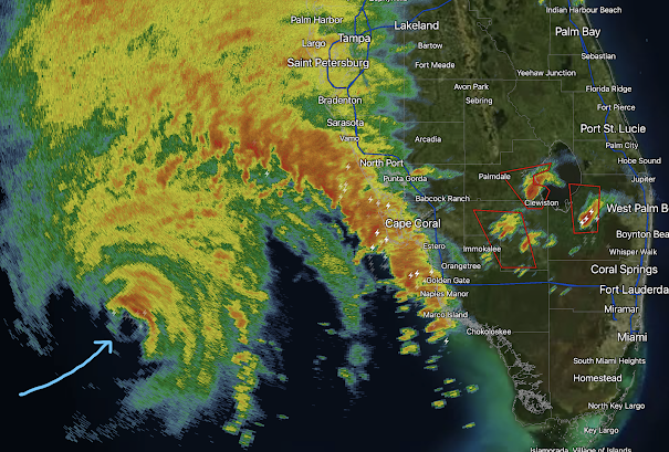 A tornado watch is in effect for Florida south of I-4.

Do not focus on the "M" (major) symbol but rather the white shading. That will be the zone in which the eye will make landfall. The storm has weakened this morning as dry air has come in from the west. However, it will still be a major hurricane (I'd estimate 115 mph) at landfall. It is critical to remember that the surge is baked in. While we cannot forecast the exact point of highest surge due to the uncertainty of the exact spot of landfall, all of the Florida Gulf Coast should evacuate where under evacuation orders.
Radar at 11:16am. The arrow is pointing at the eye. More the tornado warnings (red polygons) over the Peninsula.

Flooding is likely with this vast amount of rain, especially near and ~50 miles north of I-4.


Comments
Post a Comment