
Extreme Precipitation in the West This Week
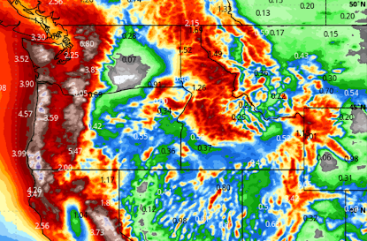
A major pattern change will occur this week this week bringing heavy rain and heavy snow at higher elevations. Above are forecast rain and the moisture content of snow for this week. The amounts will likely be sufficient for localized flooding in the areas where it is not in the form of snow -- especially in California. Below are the forecast snow amounts for the week. If these forecasts are correct, it means that the snowpack will be greatly improved infall of these areas. A cold front the first of the week will usher all of this in. Here is a timing forecast. Please take these forecasts seriously and factor them into your plans.

