
Posts

Showing posts with the label Thanksgiving travel

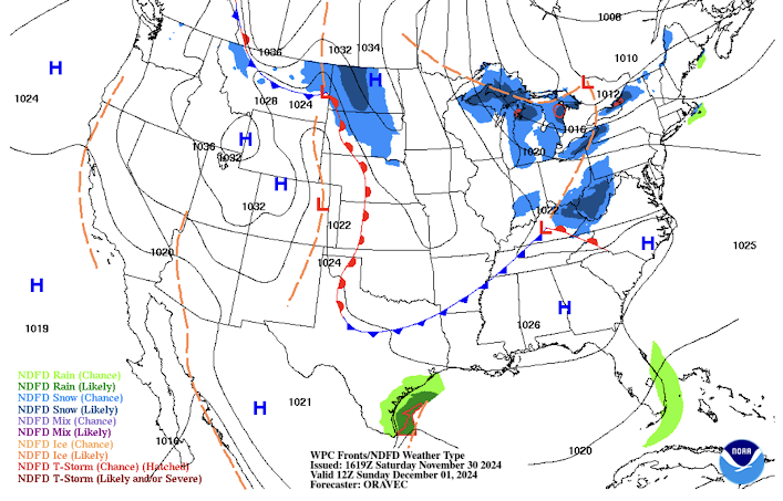
Noon Sunday Travel Weather
Image
Heavy snows will continue southeast of each of the Great Lakes. Significant snow will also be falling at noon in West Virginia and the northern Great Plains. Other than that, conditions will be generally good for travel.

Thanksgiving Travel Weather, 8am Thursday

Image
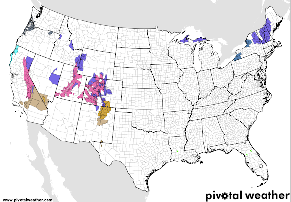
National Storm Warnings Winter storm warnings continue in Colorado and Utah (pink) with high wind warnings for New Mexico. Purple = winter weather advisories. The gray in the South is dense fog advisories. Winter storm watches in effect for parts of New England.  Below is the forecast for 6pm CST today: The snow in Colorado and Utah is forecast to taper off by 6pm. Forecast for 6am Thursday Radar at 7:54am: Snow continues in Colorado with a mix of precipitation near the Kansas-Nebraska border that is mainly sleet.  Travel safely!!

Thanksgiving Travel Update, 9:20am CST Tuesday

Image
Here is an update as to pre-Thanksgiving travel weather.  Weather Warnings Pink, winter storm warning. Purple, winter weather advisory (lesser condition) Dark turquoise, lake effect snow warning Brown and amber, high winds Light turquoise, freeze warning  Forecast for 6pm CST this evening.  Forecast for 6pm Wednesday. 

Updated Thanksgiving Travel Weather

Image
Here is updated travel weather as ofd 1:15pm CST Monday: Forecast Tuesday at Noon Central Time Some things to look for. Note the "organ" in northern New England: that is ice in the form of freezing rain. Allow lots of extra time.  Wednesday, Noon Central Time A mix of rain or snow is possible from I-70 in western Kansas to near Denver as well as along I-15 in southwest Utah. Heavy snow is forecast in the Colorado mountains and Wasatch.  Rain is likely in Southern California which generally causes traffic jams disproportionate to what a light rain causes in other parts of the nation. Lake effect snow is likely near the Great Lakes.  Have a great Thanksgiving!!