Important: Please factor these forecasts into the your weekend and early-week plans.
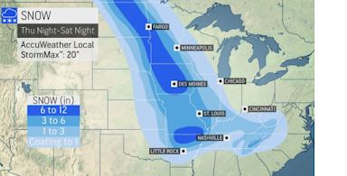
As the storm moves southeast through the Midwest Friday and Friday night, here are the forecasted snow amounts:
The maximum amounts are likely to be in Iowa, north of Des Moines. Give or take two inches, Des Moines should have 7-8 inches and Kansas City 4. Looks like St. Louis will have 3-4 inches.
Snow times of arrival, ± 2 hours.
- Des Moines, 6am Friday
- Kansas City, 1am Saturday
- St. Louis, 9pm Friday
- Branson, 6am Saturday
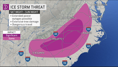
As the storm 'rounds the bend (turns to the east, then northeast) in the South, an area of freezing rain is forecasted to occur.
We are about 12 hours away from being able to make a specific forecast as to the threat of power failures, but it certainly exists. There is also a risk of tree damage. I urge you to make sure you have everything you need for
at least two days if you live in the deeper purple area.
There are two areas of special concern: Middle Tennessee and northern Georgia+western Carolinas. Heavy snows of more than four inches are likely in at least parts of these areas which are not used to receiving this much snow.
I would urge you to complete your travel before the snow begins!!
Snow times of arrival:
- Nashville, 11am Saturday
- Asheville, 8pm Saturday
- Spartanburg, 8pm Saturday (freezing rain)
- Washington, 6pm Sunday
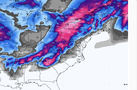
There will be significant wind east of the Appalachians, so there will be at least minor drifting of the snow.


Comments
Post a Comment