
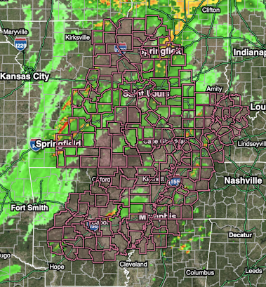
4pm Tornado Watch Update
The tornado watch has been significantly enlarged in Missouri and Illinois (pink) till 11pm.
-- original posting --
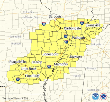
The above is the tornado watch which is in effect until 11pm. The NWS is explictly forecasting "several strong tornadoes" in this area. Many of the tornadoes will occur at night -- which makes them three times more dangerous than tornadoes during the day.
Here is the radar at 4pm.
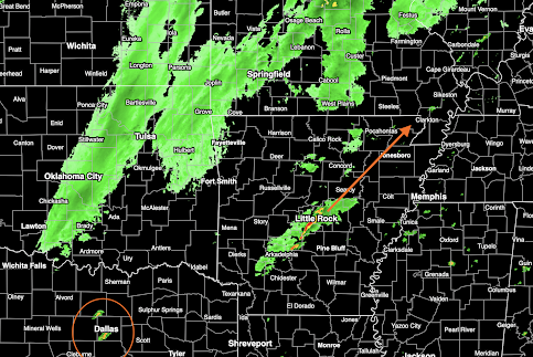
Other thunderstorms have developed in the DFW Metroplex. They could become severe later.
Please monitor the weather if you live in the tornado watch area.
This will be my last blog update. Follow me the rest of the evening on Twitter @usweatherexpert.


Comments
Post a Comment