
Winter Storm Update - Snow Amounts Increased
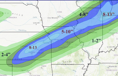
I have increased my forecasted snowfall amounts because this looks like one of the most favorable thundersnow situations in years in Kansas and western Missouri. In addition, winds will gust to 40 mph and locally higher, meaning near blizzard conditions are possible.
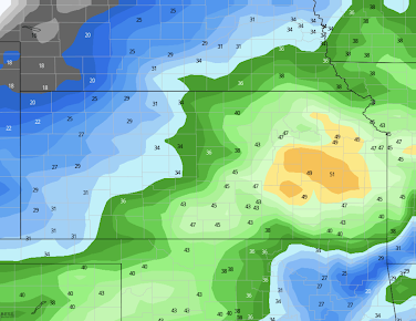
Below is a forecasted wind gust map for 9am Thursday.
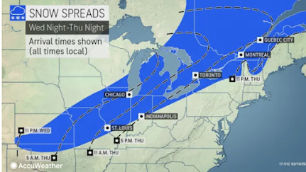
Snow timing map from AccuWeather.
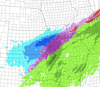
Forecast radar for 9am Thursday.
Here is the NWS's winter storm (blue) and flood (green) watches. Magenta is a fire weather warning.
The browns are wind advisories.

The tornado outlook (see posting below) is unchanged.


Comments
Post a Comment