Note to Readers as of 1:15pm Tuesday: This preliminary forecast still looks good. I will have a full forecast up late this afternoon.
-- original post --
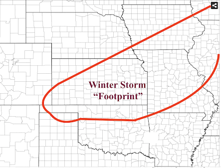
I decided to create and post an earlier than scheduled update because this evening's data indicates that the storm will be more intense that I first thought. The storm will begin in the central Great Plains Wednesday night.
You may wish to move travel up or significantly back. Note: the footprint is somewhat larger geographically than what might actually occur. This is a preliminary forecast.
Within the Winter Storm Footprint: snow, heavy in places; freezing rain and/or sleet; and winds gusting as high as 40 mph which, if combined with freezing rain or snow, will cause significant problems. You may wish to consider moving
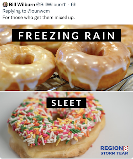
Reminder about the difference between freezing rain and sleet below.
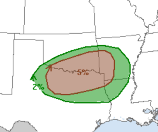
In addition, there is a risk of tornadoes and severe thunderstorms Wednesday evening and night in the yellow area. The severe thunderstorms will move into the Lower Mississippi Valley and Deep South Thursday. The map below, in brown, is where there is a significant tornado risk.
I will update Tuesday and will include a forecast for points east of the Mississippi.


Comments
Post a Comment