The Rapid Progress in Severe Storm Forecasting
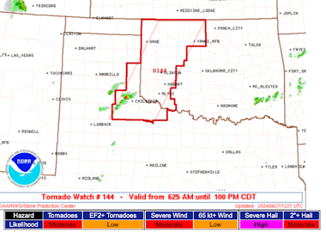
One of the topics of Warnings is the rapid progress that has been made in severe storm forecasting the last ten years. Yesterday's hailstorms are an excellent example.
At 8:58am CDT yesterday, I posted:
The hatched area on the graphic shows the potential for hailstones 2 inches in diameter or more. The yellow line is a 30% probability and the blue line is a 45% probability of hail at least 1" in diameter.
At 6:28pm, I posted:
Vicious hail storms swept across the region where the hail was forecast during the following four hours. Here is a map of hail reports with the sizes indicated:
And, here is a closeup of the hail tracks north and south of downtown Kansas City:
With more than twelve hours of advance notice, it should have been possible to put cars in garages, bring outdoor furniture indoors, round up pets, etc. The forecast of the potential for very large hail and its location was excellent.
Weather science is making amazing strides that make our lives safer and can help prevent property losses. That is the story I tell in Warnings.
At 8:58am CDT yesterday, I posted:
The hatched area on the graphic shows the potential for hailstones 2 inches in diameter or more. The yellow line is a 30% probability and the blue line is a 45% probability of hail at least 1" in diameter.
At 6:28pm, I posted:
Vicious hail storms swept across the region where the hail was forecast during the following four hours. Here is a map of hail reports with the sizes indicated:
 |
| Click to enlarge. Wichita is in the far lower left corner. Downtown Kansas City toward upper right. |
With more than twelve hours of advance notice, it should have been possible to put cars in garages, bring outdoor furniture indoors, round up pets, etc. The forecast of the potential for very large hail and its location was excellent.
Weather science is making amazing strides that make our lives safer and can help prevent property losses. That is the story I tell in Warnings.


Comments
Post a Comment