Hurricane Ida Has Made Landfall
 |
| Radar 12:18pm CDT |
As of noon, Hurricane Ida made landfall at Port Fourchon. Louisiana. It had sustained winds of 150 mph with a lowest pressure of 929 millibars -- a Cat 4 storm. Port Fourchon is a major energy center for our nation.
Storm surge is forecasted to be up to 16 feet (!) which does not include tides and waves. Imagine being at the bottom of a sixteen foot deep swimming pool only with the water driven by hurricane-force winds. The destruction will be terrible.
Below is a map of forecast wind speeds. Click to enlarge.
Catastrophic structural damage due to the combination of storm surge and wind will occur. Power outages will last for at least days; 250,000+ people are already without power. That number will rise drastically.
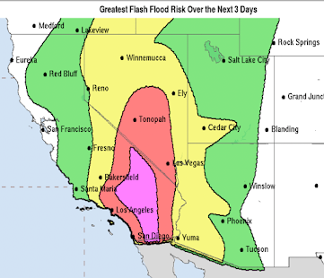
Below is the relative flash flood risk.
If you are in southeast Louisiana, you need to shelter as if it were a tornado until the storm passes or weakens.
Catastrophic structural damage due to the combination of storm surge and wind will occur. Power outages will last for at least days; 250,000+ people are already without power. That number will rise drastically.
Over and above the storm surge will be freshwater flooding in the areas in orange or yellow. Some of the inland flooding could be life-threatening. Please monitor this situation.
There is a high risk of tornadoes between now and 6am Monday in the area outlined below.
 |
| Nadocast |


Comments
Post a Comment