
Central Great Plains Winter Storm
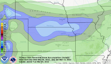
Update: 12:30am Wednesday. It now appears that the amounts on the snowfall forecast should be pulled about 30-40 miles farther to the south. I'll have an update on this later today.
--- original post ---
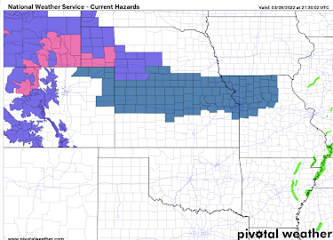
- Dark green = winter storm watch for late Wednesday and Thursday.
- Pink = winter storm warning Wednesday and Wednesday night.
- Purple = winter weather advisory (lesser condition).
- Greens = winter flood information.
Here is a map of the preliminary snowfall forecast to 6pm Friday.


Comments
Post a Comment