Storm Threat Getting Organized
AccuWeather regional radar at 8:15pm CDT shows strong thunderstorms over the High Plains. A few tornadoes have been reported in southwest Nebraska.
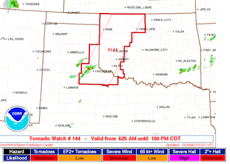
The large hail and tornado threat continues for the next few hours in the outlined area:
For tomorrow, things look a little more iffy. I believe far northern Oklahoma into southern Kansas and the Flint Hills could have severe thunderstorms -- with tornadoes possible -- along a weak front that should draped across the area.
Saturday still looks like a very big day:
and, for Saturday evening:
If you live in the colored areas on Saturday, keeping up on the weather will be essential.
The large hail and tornado threat continues for the next few hours in the outlined area:
For tomorrow, things look a little more iffy. I believe far northern Oklahoma into southern Kansas and the Flint Hills could have severe thunderstorms -- with tornadoes possible -- along a weak front that should draped across the area.
 |
| Between 6pm and 11pm with the best chance between I-40 and U.S. 54 The storms will move northeast into Kansas by around midnight. |
 |
| This is valid afternoon Saturday |
If you live in the colored areas on Saturday, keeping up on the weather will be essential.


Comments
Post a Comment