An Update About Modern Tornado Warnings
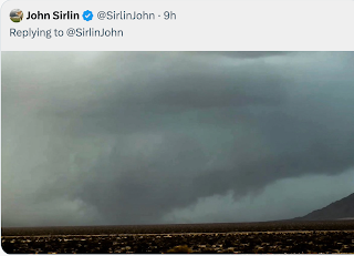
Here is a tweet of mine from Thursday evening.
And, here is a headline from the Tampa Bay Times today.
This small tornado (EF-1 intensity) carved a nine-mile path through the Tampa Bay area.
This particular situation brings up several important points as we begin tornado season 2020.
And, here is a headline from the Tampa Bay Times today.
This small tornado (EF-1 intensity) carved a nine-mile path through the Tampa Bay area.
This particular situation brings up several important points as we begin tornado season 2020.
- This type of tornado is known to meteorologists as a "QLCS" (I won't bother you with the details). It used to be considered "unwarnable." Now, we can often do a decent job, especially in areas like Tampa that have a TDWR or other high-resolution radar that provides data at one-minute intervals.
- While I urge everyone in a tornado warning (red polygon) to take cover when a warning is issued, if you are in an area that is being singled out (in this case, Pinellas Park and Gandy), move very quickly to shelter! Again, while there are exceptions, we as a science are getting better at focusing on the areas at greatest risk.
- However, I recently read that emergency managers and others are lobbying the NWS for time-of-arrival info for tornadoes for all tornado warnings. That is a bad idea. Why? Tornadoes speed up and slow down and sometimes lift while another touches down nearby. This type of small-scale behavior is not well understood and we can't factor it into our warnings. If we were to say, for example, "Pinellas Park, 10:47pm" and the tornado hits at 10:43, then what? Besides, I believe that by giving a 'precise' time tens of minutes in the future, we are taking the urgency out of the warning (e.g., if a town in the warning is not supposed to be struck for another 40 minutes) and making it less likely people will respond.
Hope this is helpful and I hope the 2020 tornadoes are few and far between.


Comments
Post a Comment