Forecaster Evie: Heads Up This Week!
This graphic is from the SPC and 15% is the significant threshold. The hatched area is where very large hail (including egg-sized!), very high winds and tornadoes are more likely.
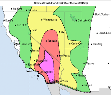
The second graphic is for Thursday and Thursday night. The red area is a concentrated threat.
So, take this time in the interim to make sure you have two methods for getting warnings (TV+weather radio+plus cell phone app+portable radio, etc.) and fresh batteries for a radio, flashlight, etc.


Comments
Post a Comment