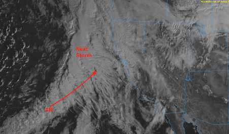
Update on Approaching California Storm: Updated 2:30pm PST
Latest satellite image shows the next storm off the coast of California as well as the atmospheric river (AR) attached to it.
Additional Information: The researchers at Scripps just tweeted about this situation and their analysis is essential the same as mine.
Below are the forecast model precipitation amounts map between now and Wednesday night.
Here is the National Weather Service's latest forecast precipitation amounts from 4pm this evening to 4pm Wednesday. The storm is taking a slightly more southern path and only light to moderate amounts are forecast in southern Oregon.
Here is a forecast of snow in the Sierra.


Comments
Post a Comment