Posts

Showing posts from September, 2023

If You Enjoy This Blog...

... please consider following me on Twitter or X or whatever they are calling this week. I'm @usweatherexpert.  There is the potential for severe thunderstorms next week and you'll find most of my storm warning coverage on Twitter.  Thank you. 

Storm Total NYC Rainfall

Image
Here is the total 24-hr rainfall to 11pm EDT. I've highlighted the rain so you can see the the pattern. And, here is the same map with the geography made more prominent.  There was a similar flood in July, 1903 with Brooklyn officially recording 8+ inches of rain, so this storm was highly unprecedented. And, just three months later, the flood of record occurred on the Passaic River in New Jersey. A warmer climate is not needed to produce extraordinary rainfall in the NYC region. Dr. Ryan Maue's plot of heavy rainfall days in NYC pretty much demonstrate there is no climate signature on this event.  And, Andy Revkin has some thoughts about "debuilding" to mitigate the damage extreme rainfall can create. 

NYC Flooding

Image
Undoubtedly, you have heard the media reports about the flooding in New York City.  Flooding at LaGuardia. New York Post Rainfall till 3pm EDT. There was an area of 7" south and southeast of Kennedy Airport. Here is the radar as of 3:12pm EDT. Flooding continues to worsen in western Long Island.  The line of thunderstorms (red) that has caused the flooding continues to move north northeast.  The flash flooding in NYC was very well forecast. Here's an example from Dr. Ryan Maue from yesterday. The problem is that school districts did not call of school based on these forecasts nor did other businesses take proactive measures.  Great weather forecasts do not one any good unless they are acted upon. Late News:  The info below came in at 4:52pm. 

Must Read Article About the 'Green Economy"

 An article highly recommended by Dr. Judith Curry. I completely agree with her. Excerpt: "The green economy isnt a capitalist economy, where companies compete with one another to produce the best product at the lowest price and countries attract businesses and talent based on their comparative advantages; instead, it is characterized by central planning and multinational firms shopping around for which jurisdiction can offer the biggest corporate handouts, forcing countries to compete over who’s willing to pony up the biggest bribes." The 'green' economy is loaded with favoritism and, based on circumstantial evidence, a fair amount of graft.  The article is in Canada's " National Post ." I also agree 100% with this quote: The idea that the green revolution would herald a glut of new green jobs has proven to be a pie-in-the-sky fantasy, if not an outright lie. I urge you to read the article. 

Drought and Rainfall Forecast Update

Image
Palmer Drought Index. Brown/reds = dry. Blue/greens = wet. The latest Palmer Drought Index (based on data through the 22nd) depicts the drought in the Northwest and in the Midwest, especially west of the Mississippi River. There were also drought condition in parts of the Middle Atlantic and south central region.  Here is the rainfall since the data cut-off on the 22nd. The dryness in the Middle Atlantic Region and Northwest have been replaced by substantial rains, The 5-day rainfall forecast of rainfall amounts   is below. Additional rains will fall in the winter wheat belt after the above 5-day period is up. That means improved planting conditions. The NYC Tri-State area will receive heavy rain. 

Some Good Advice From the National Weather Service

Image

CONFIRMED: Violent Tornadoes and Tornado Damage are Down!

Image
We've taken a lot  of heat over the years for stating the obvious: both violent tornadoes and overall tornado damage are both down as compared to 50 or 70 years ago . These are inconvenient truths for global warming alarmists. Above are examples of the numerous blog posts on this topic. Now comes a peer-reviewed paper that confirms both of the above contentions .  In the authors' words:   Overall, our results suggest a downward trend in tornado losses for the U.S. as a nation, The graphs below are for F-4 (left) and F-5 tornado losses. Both are down significantly.  It has always been odd to me that global warming alarmists get so upset when these obvious scientific facts are stated because they confirm  the basic global warming hypothesis: The poles warm more quickly than the tropics. That, on average, reduces the strength of the jet stream and makes conditions for violent tornadoes less common. We haven't had an (E)F-5 tornado in the USA for more than ten years.    Of cour

Thank You!!

Image
Delighted to report that MSE Creative Consulting has been named the best business management consultant in the Wichita area. As many of you know, I work with companies that have weather or science-related challenges. If you would like to learn more about weatherproofing your business or establishing a new science-based business, please go here .

Two Kudos and One Demerit

Image
I've been in Kansas City the past few days and I have a couple of comments to pass along in case they are helpful.  Two Kudos to Kansas City Union Station The first is for showing the IMAX movie, Train Time . I attended with Kathleen and my brother and sister-in-law. It is outstanding! My brother said, "It could be three times longer and it wouldn't have been long enough (it runs 50 minutes)!" The movie takes the topic of railroading and makes it fascinating.  Five Stars!  You may want to see if it is playing in an IMAX theatre in your area. The second kudos also goes to Union Station for having clearly marked signs indicating where to go in case of a tornado warning. Well done! The Demerit Goes to the Kauffman Center for the Performing Arts.... ...for its lack of storm warning signs and for the advice in the program to "sit in your seats and wait for further instructions" if there is a tornado warning.  As Herb Alpert noted Thursday evening, the facility is

"AI" ... A Word of Wisdom.....

Image
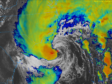
....being a degreed atmospheric scientist who has functioned in engineering mode from time to time for more than 50 years, I have seen a lot of scientific fads come and go. Right now, we are in a doozy: AI. Headline from an ad received Friday afternoon Even on the radio it is, "AI, this; AI, that." Most of it meaningless.  From the Glossary of Meteorology, the definition of AI: Multidisciplinary field encompassing computer science, neuroscience, philosophy, psychology, robotics, and linguistics, and devoted to the reproduction of the methods or results of human reasoning and brain activity. There are no commonly accepted definitions as to what comprises AI applications in the real world. So, if some advertisement says it is "AI," that may or may not be the case.  And, if you take away nothing else from this brief comment, remember this: If there is such a thing as artificial intelligence, there must be such a thing as artificial stupidity!

Sunday Fun: High Class Tire Store

Image
After our long trip last week, my dashboard tire gauge alerted me to a possible problem. Sure enough, there was a blister in one of my tires.  While I was waiting, I looked down and learned I was sitting in a classy tire store.

3:40pm Tornado and Severe Thunderstorm Update

The forecast below still looks good.  I'll be providing additional updates on Twitter @ usweatherexpert. 

Today's Tornado Risk

Image
On this first day of astronomical autumn, we have a springlike weather situation with tornadoes, giant hail and damaging thunderstorm-generated winds all possible. Note: there are thunderstorms roaming parts of this area right now. This does not affect the forecast below which is for after 2pm this afternoon and evening.  Tornado Risk The brown area has a significant risk of tornadoes. However, there are indications the may be a somewhat higher risk in southern Minnesota and northern Iowa. Giant Hail The hatched area is where hail 2 inches or more in diameter is forecast to fall. Elsewhere in the yellow area 1-2" hail is forecast with a significant risk. The red area is at an enhanced risk level. Damaging Thunderstorm-Generated Winds The yellow area has a significant risk of thunderstorm winds of 60 mph or stronger. The red area has an enhanced risk. I will provide an update this afternoon. 

Flood Risks East and West

Image
Now that Ophelia is inland, we should concentrate on the risk of flooding in the East. Because parts of the are dry, I don't expect major flooding. However, in the Northwest, there is high risk of flooding if this five-day rainfall amount forecast is correct.  Please monitor local weather information for more specific info. For more: Please follow me on Twitter @usweatherexpert . 

10:50pm Update on Ophelia

Image
Radar of Ophelia at 10:46pm. Blue = eye. It is moving north northwest at 12 mph. Winds are still 70 mph even though pressure has dropped to 984 millibars. There is still a chance it will officially reach hurricane force (75 mph) before it makes landfall early Saturday.  There is considerable flooding due to the deepening storm surge. High tides will be after midnight, so dangerous flooding is likely in coastal areas.  Tornadoes are likely during the night in eastern North Carolina. 

5:15 pm Update on Ophelia: Hurricane Watch Issued!

Image
Ophelia has clearly strengthened and become better organized since my 11am update. The barometric pressure has dropped from 992 mb to 987 mb. The center of the storm has become surrounded by thunderstorms which is a signal of thunderstorms (lightning). Maximum sustained winds are now 70 mph. Keep in mind that hurricane force is 75 mph. The storm is almost that strong. In addition to hurricane or near hurricane-force winds, there will be a life-threatening storm surge.  There is also a risk of tornadoes tonight.  Here is the path of the storm this weekend. Amber color is the current area of 40+mph winds. 

3:45pm EST Friday: Tropical Storm Ophelia Strengthening

Image
Red "O" is the center of Ophelia Based on both data from a Hurricane Hunter aircraft inside the storm plus the latest satellite imagery, it appears that Ophelia is strengthening and hurricane intensity before landfall is not out of the question.  One of the signs of a strengthening storm is lightning near the center. There is considerable lightning at this time. Hurricane Hunters are showing both stronger winds and  the lowest barometric pressure has dropped about 4 millibars since 11am.  If I were living near the North Carolina coast, I would be monitoring the progress of this storm.  Remember, there is a storm surge warning for the North Carolina coast and there is a risk of tornadoes of tornadoes tonight in addition to strong tropical storm force winds.

Tropical Storm Ophelia Is In Progress

Image
The "O" represents the center of what is now Tropical Storm Ophelia as of 2pm EDT. The rest of the forecast (scroll down) is still valid. I turned on the colors to represent the thicker (heavier rain) clouds. 

Today's Tornado Risk

Image
We have two well-separated risk areas.  East Coast The brown area has a "significant" category risk area is a result of the approaching tropical depression/storm.  High Plains This, too, is a "significant"-level risk area. 

11am Update on Tropical Depression

Image
As of 10:45am, the center of the tropical depression is indicated by the "TD." It is moving north northeast and has 50 mph sustained winds. It is forecast to reach peak intensity tonight with winds of 65 mph. It is not  forecast to reach hurricane intensity. Here is the forecast path. However, please note: the amber is the field of winds of 40 mph or stronger. The strongest winds are not  concentrated around the center.  Between now and 8am Saturday, there is a good chance of a few tornadoes in the brown area. Localized flash flooding is possible with the heavier rains.  Combined with the flooding from rain, there will be a coastal storm surge with this system. While I do not expect the forecast to change much, I'll have an update this afternoon.

Review of Herb Alpert and Lani Hall Concert, Kansas City, September 21st

Image
Eighty-eight years old and he can still blow that horn! Listen to the end of A Taste of Honey. I thoroughly enjoyed myself -- Kathleen had to stop me several times from drumming or singing (except when the audience was invited to do so by Herb or Lani).  Herb, like my late brother-in-law , is a breed of man that America -- to its discredit -- doesn't make nearly as often as it used to -- but still desperately needs. Men that, when something needs to be done, just do it . They don't ask permission. They don't check with the government. They just do it.  The concert was a mix of oldies like Rise, Route 101  (my all-time Alpert favorite) and songs from the TJB era as well as some of his newer recordings. He included a moving tribute to the late Karen Carpenter with a wonderful version of We've Only Just Begun  on the trumpet. Alpert, along with the late Jerry Moss, were the founders of legendary A&M Records which was the Carpenters' label.*  Lani Hall, for those

4:10pm CDT Tornado and Tropical Storm Update

Image
The area in brown has a significant risk of tornadoes until around midnight. There is also a risk of hail up to 3" in diameter.  Tomorrow, there is a risk of tornadoes near and east of the path of developing Tropical Storm Ophelia.  The National Hurricane Center has issued tropical storm warnings (blue) from the Virginia-Deleware  border south to Wilmington, NC. (S) = potential tropical storm. S = tropical storm (winds in this case 40-60 mph) (D) = post-tropical depression Peak sustained  winds are forecasted to be about 55 mph with this storm with stronger gusts.  There is also a storm surge warning for the area in yellow with a lesser storm surge in blue. Note the blue storm surge (1-3') extends north and south of the tropical storm warning.  Rains of more than five inches near the path of the of Ophelia may cause flooding.  I'll have another update tomorrow morning. 

Tropical Storm Developing For the Middle Atlantic Region

Image
Tropical Storm Warnings now in effect from coastal North Carolina to coastal Delaware. Sustained winds may reach 55 mph and a significant storm surge may develop.  I'll have more this evening.