7:45 pm Tuesday Hurricane Lee (Update for Storm Surge)
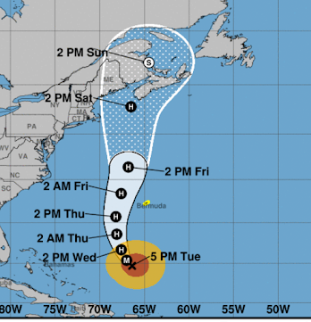
Above is the 5pm forecast from the National Hurricane Center. M = Major hurricane ( ≥ Cat 3). H = Hurricane. (S) = non-tropical storm with winds between 40 and 74 mph. It predicts the path of the eye of the storm. To the right of the eye of the storm, there will be a huge storm surge that may be 5' or more on top of the tides and waves of 12 to 25 mph. These will cause a great deal of damage along the coast. That is why the path of the center of the eye matters.
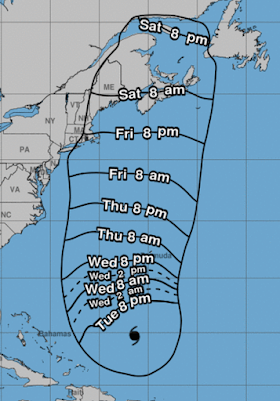
Below is the earliest likely time of arrival of sustained 40 mph winds.
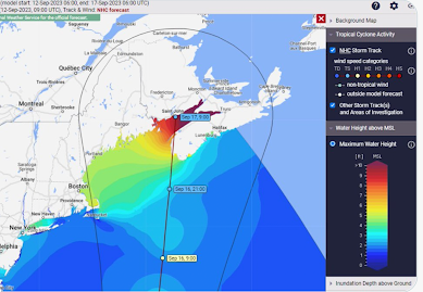
Update pertaining to storm surge (7:45pm). More than 9' of storm surge forecast for the Bay of Fundy. Much of the Maine coast is forecast to have ~5' surge.
I do not expect a significant risk of tornadoes with this system.
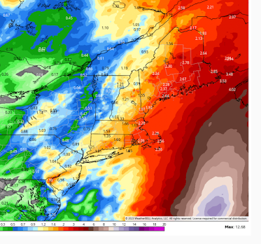
Flooding is possible over eastern New England. See rainfall forecast below.
What I recommend at this point if you live in the Maritimes or in New England coastal areas:
- Get plenty of cash. ATM's and credit card readers do not work without electricity. There will be widespread power outages.
- If you have a gasoline-powered car, keep it filled with fuel.
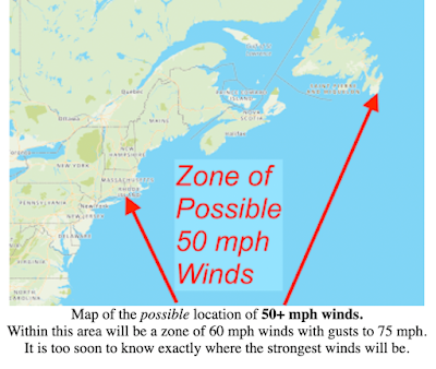
- In Nor'easters, the worst winds usually come from the north through east. In this storm, the worst winds will come from south through southeast. There will also be much more of a storm surge and corresponding flooding. There will be 12-25 feet waves near shore on top of the storm surge. Please plan accordingly as they can be highly destructive.
- Put together a "go kit" in case you have to evacuate.
Remember, you can always re-deposit the money if the storm does not affect land and you'll eventually use the fuel.
My next update will be tomorrow morning.



Comments
Post a Comment