Posts

Showing posts from March, 2024

Monday's Tornado Outlook

Image
The area in brown has a significant risk of tornadoes.  Better chance is Monday afternoon and night.  There is the likelihood of giant hail (>2") in the hatched area, with an enhanced  likelihood in the red area with hatching.  Of course, I will update this forecast Monday.  Please check back. 

Happy Easter, Everyone!!

Image
The most joyous day of the year for Christians. The resurrection of Christ. Hope it is a wonderful, and holy, day for you and yours.  Given America's current troubles, I offer this reading to Christian s everywhere. 

I Didn't Know Dust Devils Were Strong Enough to Be an Aviation Hazard

Image
Please see:

Tornado Risk Monday - Heads Up!

Image
Long-time readers know that I worry about tornadoes on holidays, especially school holidays. People are out of their normal routines and may not hear watches and warnings with the same likelihood as they generally would. Many parochial schools have the day off Monday, the day after Easter.  The NWS Storm Prediction Center is forecast tornadoes and severe thunderstorms in the areas outlined below.  A long range severe thunderstorm and forecasting tool from Colorado State University, which has demonstrated skill, is forecasting even higher probabilities Monday and Monday night. The hatched area is where giant hail and/or strong tornadoes are forecasted to occur. On a Day 4 severe weather outlook, a probability of 40% (purple) is quite high.  Of course, this can shift a bit between now and Monday, so it will be important to monitor the weather from the Great Plains into the Midwest and South. I will post updates each day. 

Outlook For Easter Sunrise Services

Image
This is the forecast for 8am Eastern Time/7am Central/6am Mountain/5am Pacific. The upper map is the wind chill valid for that time. The scale is at the bottom.  Below is the precipitation map. Fortunately, rain will not be widespread Sunday morning.  This is the lightning forecast. It shows forecast cloud-to-ground lightning for the 3 hours ending at 8am CDT. I strongly advise against outdoor activities if lightning is present or in the vicinity. All Day Precipitation (after the above forecasts) Of course, as with any forecast, these weather features can and will shift a bit between now and Sunday morning. 

Climate for Breakfast!

Image
Global Warming: Is There Anything It Can't Do?! The answer is "evidently not" as you can now have climate for breakfast. 

This Essay is April's Required Reading

Image
It is the story of how private property rights are being destroyed in our nation .

Global Warming Absurdity

Image
Harvesting wheat in Kansas I don't know whether the correct description of the behavior the New York Times  (NYT) describes below is pitiful or just distressing: In a small room in Lower Manhattan, a group of eight New Yorkers sat in a circle sharing kombucha and their climate fears against the background of pattering rain and wailing sirens. In Champaign, Ill., a psychotherapist facilitating a meeting for other therapists held up a branch of goldenrod, asking the half-dozen participants online to consider their connection to nature. And in Kansas City, Mo., a nonprofit that runs a weekly discussion on Zoom began its session with a spiritual reading and a guided meditation before breaking into groups to discuss topics like the ethics of childbearing amid a fast-rising global population and concerns of resource scarcity. All were examples of a new grass-roots movement called climate cafes. These in-person and online groups are places for people to discuss their grief, fears, anxiet

No Energy + No Food = Terrible Policy!!

Image
This hailstorm occurred just west of Houston on March 15. It shows what happens when you combine the (far too numerous) solar farms with Great Plains hailstorms on (desperately needed) productive farmland.  Let's break this down: Obviously, solar developer wants to put their panels in areas where the sun shines often. The cloudy Great Lakes region, for example, is a bad place to put them. So, the Great Plains with its abundant sunshine -- at first thought -- seems like a great place.  The Great Plains (a/k/a "Tornado Alley) has big hailstorms. It is almost impossible to protect solar farms from large or giant hail.  Did you know that -- for the first time in the history of the Republic -- the United States has become a net importer  of food since 2020? So, valuable farmland is taken out of service for solar panels that -- as the Harvard Business Review  and other publications have recently pointed out -- wear out much more quickly than planned.  So, where are all of these --

Selling Global Warming Like Toothpaste

Image
"...the New York State Energy Research and Development Agency (NYSERDA) are hiring a public relations outfit , using $500,000 per year of public money, to 'maintain a positive narrative' and “respond to negative viewpoints” about the state’s Climate Act."   --- Above from New York Press Release          Anyone else notice that climate "science" has probably spent more on advertising agencies and public relations than every other science in history combined? One of the things I've noticed about those on the left side is the aisle is that they believe everyone else just "doesn't understand," and if they have some left-wing Hollywood celebrity or patronizing left-wing PR spin doctor, people will change their minds. After all, doesn't everyone recognize Alyssa Milano as an expert on climate?! They assume that -- regardless of being bombarded with propaganda for the past 35 years, people haven't thought about the topic.  I've often w

Kansas EF-1 Tornado With NO Warning

Image
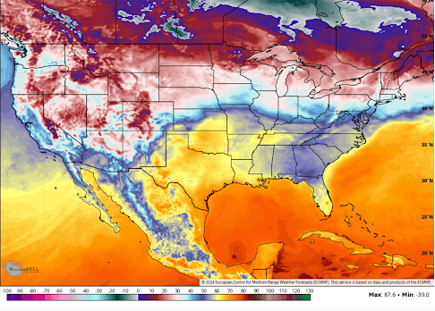
It has happened again: another damaging tornado that  should have been an easy warning -- had no warning at all.  NWS Chat, one of the photos of yesterday's tornado A tornado indicated on radar. Timely photographs of the tornado* moving into the populated area of Garden City KS. Yet, again, no tornado warning: DDC = National Weather Service in Dodge City The result: Damaged homes and businesses and at least one overturned truck.  The residents of Garden City and southwest Kansas are asking questions: KSN is a local television station NWS Chat And, this isn't the first time: On March 13, 2011 , when multiple meteorologists and storm chasers were trying to get DDC to issue a tornado warning on a storm that would later be rated as EF-2 intensity, they replied with a terse, "no." On July 13, 2023 , tornadoes developed in central/southwest Kansas and, again, no tornado warning -- even though the DDC NWS knew about them.  What in the world is going on?! This is the umpteen

Tornado Watch Issued -- Plus a Special Story About Tornado Forecasts! [Update 6:55pm]

Image
New tornado watch issued... Valid until 2am CDT. ---- This National Weather Service tornado watch is in effect until 8pm, however, the western part of the watch has been cancelled.  Pease remember: Starting around 2 o'clock, begin monitoring the weather for a tornado watch or warning.  Make sure you have at least three ways of receiving a tornado warning.  If a tornado warning is issued, or if the sky looks particularly threatening, please go to the basement and get in a closet (if you have one) or under heavy furniture like a pool table.  If you don't have a basement get into a closet or bath in the middle of the house.  Mobile home residents should go to other shelter. To find your community's public shelter go here .  In addition to tornadoes, this same area has an enhanced risk of damaging thunderstorm winds.  Today is the anniversary of the first modern tornado forecast That forecast was made at Tinker AFB outside of Oklahoma City. A completely unexpected tornado occur

Winter Weather Update

Image
Orange = blizzard warning.  Pink = winter storm warning. Purple = winter weather advisory. Sand = wind advisory (lesser condition).  Radar as of 9:25am CDT.  As predicted, I-80 is closed due to heavy snow. 

Tornado Forecasts for the Plains Today and South on Monday - Post Updated at 3:05pm

Image
New watch until 3am. A tornado or two; large hail and damaging winds. Includes DFW Metroplex.  A couple of tornadoes are possible along with hail up to 2" and wind gusts to 70 mph are likely in this area until 9pm.  Later Today and Tonight The above map, in brown, shows where there is a significant risk of tornadoes after 3pm today and into this evening. The tornado warning risk should end by around 9pm.  However,  there is a slight chance that a line of thunderstorms may form south of I-40 in Oklahoma and far north Texas after around 11pm. If that occurs, large hail and damaging winds are possible. This is a forecast map of where hail 1" in diameter or larger is forecast to fall. The yellow has a significant risk and the red has an enhanced  risk of large hail. Monday and Monday Night As above, the brown area has a significant risk of tornadoes. The yellow, hatched area has an enhanced risk  of  strong tornadoes. It will be very important to monitor the weather throughout th

Blizzard Warnings in Effect

Image
The orange is a blizzard warning. It is likely Interstate 80 will be closed and quite possible I-90, -94 -35 and -29 will be closed, also. We will also need to watch I-70 near the KS-CO border and I-25 south of Denver. Color code: Pink is a winter storm warning.  Magenta is a wildfire danger warning.  Gold is a high wind warning.  Deep blue is a winter storm watch  Purple is a winter weather advisory.  Sand is a wind advisory.  Here is the forecast snow: Below is the radar at 8:20am CDT.  Please do not attempt to travel in the heavy snow and blizzard forecast areas!

Today's Tornado Risk

Image
This forecast has been updated to include the major tornado threat in the South tomorrow.  Please click here for the update.  ---------- The brown area has a significant tornado risk beginning after 3pm this afternoon and continuing into this evening. It has been moved a bit farther to the west and south as compared with yesterday's outlook.  Pease remember: Starting around 3 o'clock, begin monitoring the weather for a tornado watch or warning.  Make sure you have at least three ways of receiving a tornado warning.  If a tornado warning is issued, or if the sky looks particularly threatening, please go to the basement and get in a closet (if you have one) or under heavy furniture like a pool table.  If you don't have a basement get into a closet or bath in the middle of the house.  Mobile home residents should go to the park's community shelter. 

Sunday Fun: World's Smallest Commercial Airport -- Been There, Done That

Image
On the Caribbean Island of Saba is the world's smallest commercial airport along with the world's shortest commercial runway. An article about it is at the link. The island is gorgeous and the people are friendly. You are likely to see a wild monkey when you are there. If you are visiting the Island of St. Martin or one of the other nearby islands, it is well worth the side trip. 

Tornado, Wildfire and Winter Storm Updates....

Image
This forecast has been updated.  Please scroll up for later information.  Updated storm warnings and watches..... Orange =  blizzard warning. Two counties of Minnesota on Lake Superior (Sunday) Pink = winter storm warning. Magenta = red flag warning ( wildfire warning for Sunday). Gold = high wind warning. Brown = high wind watch.  Sand = high wind advisory (lesser conditions for winds up to 35 mph). Dark blue = winter storm watch. Purple  = winter weather advisory. Green = flood warning Dark green = flood watch  Kansas-Oklahoma Tornado Threat Sunday Since my post, below , two objective tornado forecast programs have come out that zero in on south central Kansas.  I believe the probabilities are a little too in these forecasts, but that is not the point. The point is that since tornadoes in southern Kansas have been few and far between the past three years, do not let your guard down. 

Palm Sunday Tornado Risk in the Central Plains

Image
This forecast has been updated to include the major tornado threat in the South tomorrow.  Please click  here  for the update.  ---- Sunday afternoon and evening's significant tornado risk: In Kansas, the tornado risk area includes Medicine Lodge, Arkansas City and Wellington. This will be the first south central Kansas tornado risk of 2024... an area which has experienced below-average number of tornadoes each of the past three years.  In Oklahoma, the tornado risk includes Blackwell, Medford and Dover.  While Palm Sunday is a moving religious commemoration, it has been one of the most deadly days for tornado in United States' history. AccuWeather reports...  I've always thought Paul Huffman's photo of the twin tornadoes on Palm Sunday 1965 is one of the most terrifying ever captured. Something about two  large tornadoes, the eyes on the billboard, combined with the house that appears to be in peril -- has always gotten to me when it regards the terror tornadoes can b

Summary of Weather Warnings Across the Nation!

Image
Current storm watches and warnings. Here is the color code: Pink = winter storm warning. Gold and Amber = high wind watch/warning for Sunday.  I expect wildfire warnings to be issued Sunday.  Deep Blue = winter storm watch  Purple = winter weather advisory (lesser condition)  Green = flood watch Sand = wind advisory (winds gusting to 35 mph) Note: we have previously covered the departing storm in Maine, I am not going to cover it in this post. Here are the flood outlook for the next 36 hours. Major Winter Storm Imminent Yes, that is as much as two feet of snow on the Minnesota-South Dakota border. Sunday night, there is a good chance of wind gusts in the 30-35 mph range, which is near blizzard criterion, which makes mild to moderate drifting possible.  Forecast radar at 7pm Sunday: Note: some roads will likely be closed along with school closures. There will be significant flight delays at the Minneapolis airport.  Radar at 11:20am.