
Friday Night Football With Large Hail and Damaging Wind Threat
We don't normally cover severe thunderstorm watches on the blog unless the meteorological threat is extraordinary. Making an exception because of the popularity of high school football in this region and the fact this severe thunderstorm watch is in effect from now until 1am CDT Saturday morning.
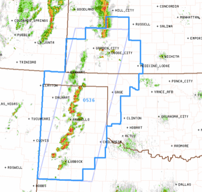


The NWS Storm Prediction Center is forecasting hail to 1" in diameter and wind gusts to 70 mph along with the threat of deadly lightning from these storms. Games should be suspended and everyone move to shelter if lightning approaches.
There is a second area where the storms may intensify as the evening progresses (blue scallops):
In both areas, the storms will generally move from southwest to northeast at 35 mph (i.e., a half-mile per minute).
I have a full set of school and football safety rules at Answers.com.
Note: I'm not live-blogging the storms this evening.


Comments
Post a Comment