Posts

Showing posts with the label floods

A Great Source of Spring and Summer Images

Image
You will find hundreds of professional, curated images in my gallery at Adobe Stock Photography .  I do not use filters -- what the images present is how it looked in real life. Adobe has high standards so I think you will find that, even if you are not in the market for stock photography, you will enjoy pursuing the images. We have images from wildfires to floods and from tornadoes (and tornado shelters) to blizzards. 

Unusual Storm Middle Atlantic Coastal Areas

Image
From the NWS in Washington:

What a Weird Winter It Has Been

Image
The Weather of April 5, 2025: Tornadoes? Yes, and for the 5th day in a row.  Severe flash flooding? Yes.  Heavy snow in west Texas. Amazingly, yes! Blue = snow, with darker blue corresponding to heavier falling snow. Amber = tornado watches. Green = flash flood warnings. Red = hail or torrential rains. The radar image is from 4:05pm. 

Never Try to Swim in Floodwaters...

Image
Here is a list of what floodwaters can contain... Stay away from floodwaters!!

Update on Midwest and Southwest Floods

Image
Legend It has been a relatively wet ten days in the Southwest and there is the potential for flash flooding in the region this week. In the Midwest, major flooding continues. Unfortunately, additional moderate rainfall amounts are forecast to occur the next five days (below). 

Flood Risks East and West

Image
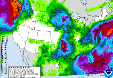
Now that Ophelia is inland, we should concentrate on the risk of flooding in the East. Because parts of the are dry, I don't expect major flooding. However, in the Northwest, there is high risk of flooding if this five-day rainfall amount forecast is correct.  Please monitor local weather information for more specific info. For more: Please follow me on Twitter @usweatherexpert . 

The 19th Century California Megaflood

Image
Some friends on Twitter made me aware of a Scientific American  article I missed when it was first published in 2013. It is the true story of a mega-flood that occurred throughout California (especially) and the West in the winter of 1861-62. The story is remarkable.  Below is an image of the flooding in Sacramento along K Street. The map the map depicts the almost unbelievable extent of the flooding. The story should be read by anyone interested in weather (especially weather forecasting), California history or emergency management.  Climatologists tell us that this type of flood occurs in California roughly every two hundred years.  An "Ark Storm" refers to Noah's Ark. The 1861-62 flood would certainly qualify! Except, it would be worse today because so much of the area -- especially Southern California -- is paved over and there would be exponentially more people to rescue as compared with the 500,000 people who lived in California at that time.  I do take i...

Turn Around, Don't Drown!

Image
You know you are in desperate shape when the water is flowing into the car. This short clip illustrates why you should never drive into a flood. Here is another example of what not  to do:

Flood Risk For the Ozarks and Central Great Plains

Image
Generous rains and, in many areas, needed rains fell the last 24 hours in the central Great Plains. The forecast rainfall amounts for later this week is for very heavy rains to fall from the central Plains into the Ohio Valley. If you live in these areas, I recommend keeping an eye on the weather as the week progresses.

Flooding: Caution Recommended

Image
Heavy rains have fallen over the southern Flint Hills of Kansas and Oklahoma during the last three days. The orange area has received 5 inches. click to enlarge The latest model projections (below) for the tomorrow and tomorrow night have additional heavy rains falling in southeast Kansas. In spots, more than four inches is forecast. The watersheds gather water that flows from Kansas into Oklahoma's Green County. So, if you live in an area of the southern Flint Hills, southeast Kansas, or northeast Oklahoma and your area periodically floods, I recommend you prepare for the possibility of flooding.

At Least a Temporary End to the Fire Season

Image
Extremely heavy rains are forecast for California and the Southwest over the next seven days. These rains, with snows in the higher elevations such as along I-40 in Arizona, will disrupt holiday travel. Most of the Colorado and Utah ski areas will have heavy to very heavy snows. ADDITION: Courtesy of NWS San Diego. If this forecast is close to correct, serious flooding will result.

Updated: Investigative Report: School Bus Drivers Endangering Children by Driving Into Floodwaters

Image
After video of a school bus speeding through a deeply flooded water crossing this morning near Washington, D.C., I am bumping this piece from early in the 2018 school year.  The Washington, DC, video is here .  INVESTIGATIVE REPORT: School bus drivers endanger children's lives by driving through flash floods. Will it take fatalities and law suits for this epidemic to end? One of the commenters regarding today's (July 8, 2019) video replied, I recommended they watch this video:   Note the bright yellow sign at right between the gate and the utility pole.                                     It is a flood warning sign. Another school bus, with a student and driver on board, has been carried downstream in rapidly flowing floodwaters. They had to be rescued. The driver was arrested and charged with endangerment. The dashcam video reveals the drive...

Excessive Rains Wreak Havoc to Central Great Plains Wheat Crop

Image
Flooded Wheat Field Kansas State and Oklahoma State Universities cooperated to create this special report . I urge you to read it.

Thoughts About Tornado Meteorology on the 8th Anniversary of the Horrific Joplin Tornado

Image
On the eighth anniversary of the notorious Joplin Tornado, I have a number of thoughts about weather forecasting, storm warnings and related issues. As many of you know, the Joplin Tornado, the subject of my second book , is the most deadly tornado since the government’s tornado warning program began in the late 1950’s. Scores of excess deaths occurred because of terrible flaws in the warning system that day.  Unfortunately, we have not learned some of the lessons from Joplin. As discussed in  When the Sirens Were Silent,  one of the issues was their overuse of the tornado sirens. When interviewed by KMOV TV in St. Louis a few days later, I criticized St. Louis’ emergency managers (EM) for sounding the tornado sirens the day before  50 miles behind a tornado!!  When they interviewed the EM for their story his reply was, “We’d rather be safe that sorry.” Nonsense! What they are unwittingly doing is training people to disregard the sirens. Yesterday,...

Updated Flood Outlook

Image
Since Sunday, we've been warning of tornadoes and flooding in the central third of the United States. Above is my forecast of for flood potential for the next nine days. If you live in a flood prone area put together a "go bag" now while you aren't rushed and have plenty of time.

Ascel Bio: Urgent National Health Bulletins

Image
Latest Forecast Pertaining to Water Contamination and  Food Poisoning in Flood Areas (c) 2019 Ascel Bio Ascel Bio’s  team of bio-meteorologists   has updated its forecasts for food poisoning and water pollution disease risks for flood-prone areas across the United States.   Risk advisories issued by Ascel Bio are currently in effect for the Hepatitis A, Legionellosis, and E.Coli.  There is a wide range of  products   that may be used to reduce the risks of food poisoning and water pollution, including water bottles that self-contain filtration systems and microfibre cloths to safely clean fresh fruits and vegetables. Meanwhile, Ascel Bio has also issued an advisory for rabies, which is in peak season across the USA.  Risks are expected to be elevated by flooding.  It is important to avoid wild animals and to wear protective clothing. Meanwhile, weather conditions are currently assessed by the Ascel Bio team ...

Shading News Stories To Get People to Believe in Global Warming

Image
I'm so old, I remember when most journalists simply tried to report on stories and attempted to cover both sides fairly. That hasn't been the case for decades, especially when it comes to global warming. From WattsUpWithThat : So, what happened when global warming was added to stories about storms? People aren't stupid: they are well aware that floods, tornadoes, hurricanes, etc., etc., occurred before climate was politicized and they know these same weather phenomena occurred when the problem was allegedly global cooling. Just recently, Associated Press and the Kansas City Star  have attempted to make global warming the fall guy for the severe Missouri River flooding -- in spite of the worst flood in the region being more than 150 years ago when the global atmosphere was much colder. I communicated with one of the reporters and, I regret to report, to justify tying the flood to global warming (in addition to the professor he quoted) he sent me a link to the r...

Water Forecasting

Image
Today is World Water Day. In order for water resources, which are often scarce in parts of the world, to be properly managed, weather forecasting is critical. Given the record flooding in the Midwest, I thought our readers might find interesting a comparison of a recent water forecast versus reality. The forecast below was posted on this blog on March 12th . It was comprised of the graphic from the National Weather Service and commentary from yours truly. Below is a geographic plot of all National Weather Service flood warnings plotted since the major flooding began March 14, two days after the above forecast. Even more important, the March 12 posting included the following advice: Whether is was the forecast for the High Plains Megastorm (or "bomb cyclone" if you prefer) or the above forecast of the subsequent flooding, weather science continues to provide vital information to save lives and improve society.

NOAA's Spring Flood Outlook

Image
This is NOAA's outlook for widespread flooding from now through the end of May. It does not  include thunderstorm-related flooding due to heavy rain. They are calling the flood potential for this spring, "unprecedented." Below is an explanation of the descriptive words. click to enlarge As I mentioned when I first posted about this threat, this information does not do anyone any good if it is viewed as merely interesting. Especially if you are in a "major" risk risk area, begin making preliminary precautions now:  How would you contact family and friends? How would you and they evacuate? Do you have a list of what you would take with you if you need to evacuate quickly? Things like financial records and precious family albums and records? Do you have a way of receiving flash flood and flood warnings quickly? Does your business have an alternative location or does it have a way of getting vital records and equipment out of danger? Keep your car fu...

Comments On The Incredible Nebraska Flooding

Image
The U.S. Air Force's single most important base and home of the Strategic Air Command is 30% underwater. Even the HQ building at Offutt AFB, south of Obama, is flooded. Journal-Star photo The photo below shows the main runway underwater yesterday with U.S. 75 in the background. Omaha World-Herald photo The damage may be understated in that a number of critical facilities are underground. For example, this command bunker (depicted with President Bush on September 11, 2001) is underground. The nearest flood gage to Offutt is at Plattsmouth, Nebraska. The crest was yesterday and the water has begun to fall. Arrow indicates the latest reading. This entire event has received far less attention in the mainstream media than it should. CNN home page this morning. The flood is not mentioned. The lack of coverage hasn't stopped the global warming nonsense. While this is the greatest flood of record at Plattmouth, it is not the worst flood ever. That was in 1844 ...