Posts

Showing posts with the label Mexico

Winter Storm Update, 9:35pm Sunday

Image
Blizzard of 2026 7pm: Queens was already reporting a 6" accumulation. About 126,000 people are already without power from New Jersey and states south of there. That number will grow significantly during the night as the winds come up and accumulations increase. The wind is now gusting to 35 mph at LaGuardia.  The above map is the additional  snow forecast from 9pm to the end of the storm. For example, NYC had 4-6" as of that time with an additional 17" forecast to fall, bringing the storm total to 21 to 23 inches.  The photo below was taken at 7pm on Manhattan.  NWS Warning Map Above are National Weather Service warnings: Orange = blizzard warning Pink = winter storm warning Purple == winter weather advisory Dark blue (Buffalo) = winter storm watch for lake effect snows Note the blizzard warnings are extended into coastal Maine.  The storm has organized quickly the past three hours. Radar is from 9:32pm. This is about how the radar will look 7am Monday. My advic...

645pm Update: Heads Up For Louisiana, Texas and Tamaulipas

Image
Note: this forecast has been updated. Go here for the latest.  Update at 6:45pm. The National Hurricane Center now seems to agree with my forecast.  The red area is where they are forecasting an 80% chance of a tropical depression, or stronger storm, to develop sometime during the next seven days. I believe the best chance is in the Tuesday to Thursday period for tropical storm development.  Update at 6pm: The afternoon model runs, among the models I trust, continue to show a good chance (at least 50%) of a tropical storm forming in the western Gulf. I will update this forecast Sunday morning.  Update at 1pm: The new run of the models I trust are in and my confidence has only grown that there is a threat of a tropical storm developing in the western Gulf of Mexico to the west of the orange line. The rest of this forecast (below) is still valid.  People in the USA and northeast Mexico (west of the orange line) should keep an eye on the weather this week. While t...

10am Friday Update on Hurricane Beryl

Image
Here is the color code: Red = hurricane warning.  Brown = area of hurricane force ( >75 mph) winds. Amber = area of tropical storm force winds (40-74 mph). Red = hurricane warning.  Blue = tropical storm warning. White = what is called "the cone" -- which is the area in which the  center  of the storm is forecast to move.  There can be major effects of any hurricane outside of the cone.    S  means "tropical storm" while  H  means hurricane and  M  means "major" (Cat 3-5) hurricane.  As expected, the path forecast now brings the center of Beryl onto the Texas coast. There is a significant chance the storm could come inland farther north than shown. I believe the wind speed at landfall will be in the 90-95 mph range. Power failures are likely. I expect hurricane watches will be issued late today or tomorrow morning for the Texas coast and far northeast Mexico. 

Hurricane Beryl Update: 8:40am CDT Friday

Image
--- please note, this forecast has been updated -- please scroll up The center of Beryl is over the Yucatan at this time. It is moving west northwest.  The data and models have trended more to the north overnight and NHC says that hurricane watches are going to need to be posted for at least the southern half of the Texas coast and for far northeast Mexico.  My forecast wind speed at land fall is around 90 mph (Cat 1). Keep in mind that all  hurricanes are dangerous and destructive and that power outages are quite possible.  I'll have a full update around 10:15am. 

10p Friday Update on Hurricane Beryl

Image
Here is the color code: Red = hurricane warning.  Brown = area of hurricane force ( >75 mph) winds. Amber = area of tropical storm force winds (40-74 mph). Red = hurricane warning.  Blue = tropical storm warning. White = what is called "the cone" -- which is the area in which the  center  of the storm is forecast to move.  There can be major effects of any hurricane outside of the cone.   S means "tropical storm" while H means hurricane and M means "major" (Cat 3-5) hurricane.  When the storm comes ashore in Yucatan tomorrow (perhaps near Tulum) it is expected to still be a Cat 3 storm. That is up from this afternoon.  When the storm emerges into the Gulf, it is forecast to be a disorganized tropical storm. However, it is forecast to restrengthen over the Gulf and is forecast to have 80-85 mph winds at landfall in the general vicinity of the mouth of the Rio Grande.  I will have an update Saturday morning....

8:40pm Hurricane Beryl Back Up to Cat 3

Image
  --- original posting --- Here is the color code: Red = hurricane warning.  Brown = area of hurricane force ( >75 mph) winds. Amber = area of tropical storm force winds (40-74 mph). Red = hurricane warning.  Blue = tropical storm warning. White = what is called "the cone" -- which is the area in which the  center  of the storm is forecast to move.  There can be major effects of any hurricane outside of the cone.    S  means "tropical storm" while  H  means hurricane and  M  means "major" (Cat 3-5) hurricane.  The National Hurricane Center has noticed the improved organization (scroll down) and says they are not sure whether it is temporary or whether the storm will slightly strengthen before reaching the Yucatan tomorrow. Regardless, the storm will cause considerable damage, including in the Cancun and Cozumel areas.  Most of the indicators show the storm reaching the Texas or mainland Mexico coast as a hurri...

10:10am Thursday Update on Beryl

Image
Here is the color code: Red = hurricane warning.  Brown = area of hurricane force ( >75 mph) winds. Amber = area of tropical storm force winds (40-74 mph). Red = hurricane warning.  Blue = tropical storm warning. White = what is called "the cone" -- which is the area in which the center  of the storm is forecast to move. There can be major effects of any hurricane outside of the cone.    S  means "tropical storm" while  H  means hurricane and  M  means "major" (Cat 3-5) hurricane.  Beryl is weakening at this time. However, it will cause significant wind and surf damage in Yucatan.  The storm will weaken over land but is expected to regain hurricane strength as it moves over the Gulf of Mexico. If it comes ashore in Mexico, I believe it will be along or north of San Fernando. The cone encompasses the parts of Texas which are threatened. 

Latest on Cat 5 Hurricane Beryl

Image
Here is the current forecast pertaining to Cat 5 Hurricane Beryl with 165 mph winds. A hurricane warning is in effect for Jamaica and a hurricane watch is in effect for the Cayman Islands.  Yes, the forecast has been nudged a bit to the north in the Gulf of Mexico. But, it should be pointed out that S  means "tropical storm" while H  means hurricane and M  means "major" (Cat 3-5) hurricane. 

Hurricane Beryl - Earliest Cat 5 in Atlantic History!

Image
Satellite Image at 11:20pm Latest Forecast A hurricane warning   is now in effect for Jamaica. Evacuation of tourists is a good idea, if possible. Cayman Islands should monitor closely. 

Acapulco About to Get Crushed By Cat 5 Hurricane Otis

Image
Hurricane Otis has rapidly intensified this afternoon and will make landfall with 165 mph winds and a dangerous storm surge headed for the coast of the Mexican State of Guerrero and the city of Acapulco.  More info available here .  Since posting the above, the forecast wind speed is now 150mph. If you have friends in the area, please get hold of them.

A Hurricane to Watch If You Live in the Great Plains

Image
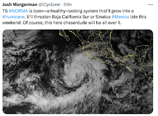
Will this developing hurricane bring desperately needed rain? Below is the latest Palmer Drought Index for the central and southern Great Plains and adjacent areas, substantial rain would be welcome. Some relief may be on the way in the form of a Pacific hurricane. Left colors are dry; right colors are wet.  Below is the forecast path for what will soon be Hurricane Norma.  In addition to giving a heads-up to resorts at Cabo on Day 5, the fact the storm will continue to move north northeast on Day 6 may allow it to be picked up so its moisture can move toward the Great Plains (below). It is too soon to know the exact evolution of this weather system but Pacific hurricanes usually provide more moisture to the central Plains than Gulf storms. We'll keep an eye on it for you.

Hurricane Lidia About to Make Landfall in Mexico

Image
5:45 pm CDT satellite image Power, category 4 Hurricane Lidia will landfall this evening on the West Coast of Mexico. The worst effects will likely be between Puerto Vallarta (PV) and Manzanilo (M). The storm has 140 mph winds with stronger gusts. There will be a life-threatening storm surge near and just south of the eye, along with inland flooding.