
The Rest of the Evening
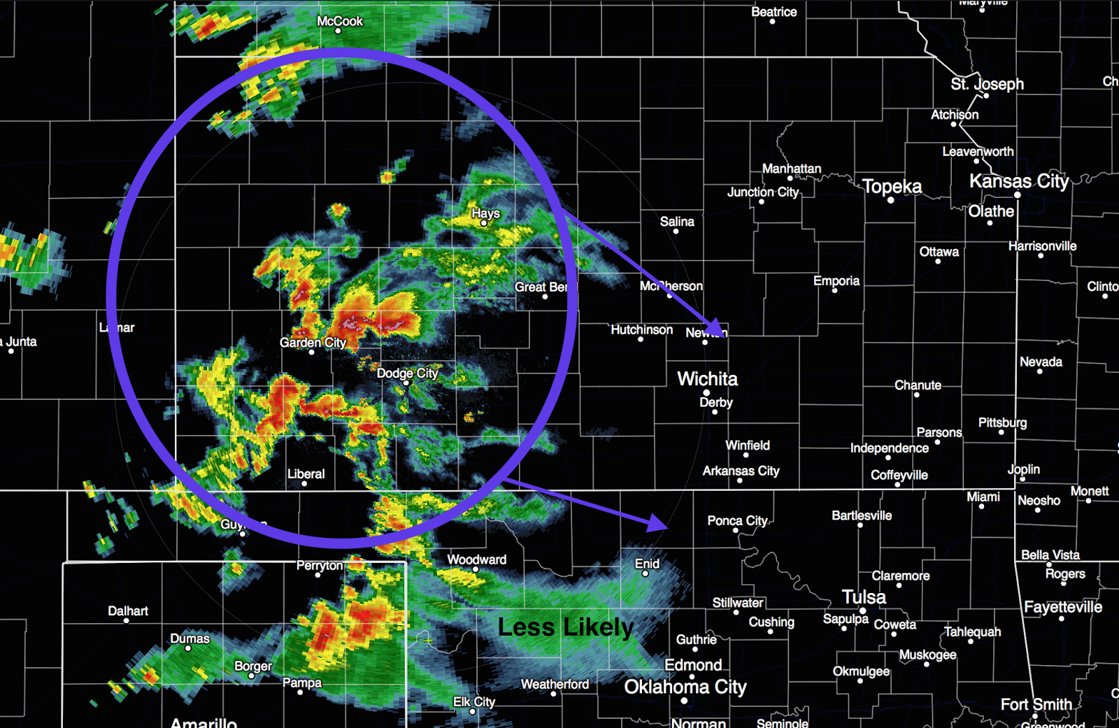
The multiple tornado-producing supercell near Canadian, TX continues. There is an unconfirmed report of injuries with them. The City of Canadian and US 83 should be aware of serious flash flooding with this slow moving complex of storms.

A severe thunderstorm warning is in effect for Tarrant Co. This will also cause locally heavy rains along with gusty, high winds.

I will not be live-blogging these storms but will have one more update later this evening. \


Comments
Post a Comment