5:15pm Tuesday: Strengthening Hurricane Idalia Heading Toward Florida Panhandle
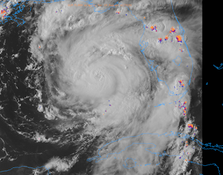
Satellite image from 5:07pm.
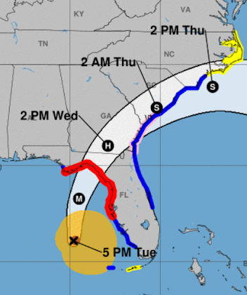
Forecast essentially unchanged from below.
However, note the "H" near Waycross, Georgia. That indicates hurricane force winds will persist across the Florida Panhandle and into southern Georgia. The M = major hurricane and the S = tropical storm.
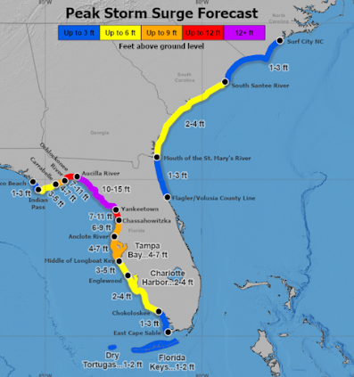
In addition to sustained winds of 125 to 130 mph near and just east of the center, there will be a (literal) killer storm surge.
The purple area of coastline is where a storm surge of 12 feet or deeper is forecast to occur. You cannot survive this unless you are in a reinforced building well above. Note also that a 4 - 7 foot surge is forecast in Tampa Bay.Below is a time-of-arrival map for sustained 40 mph winds.
Evacuations and preparations should be rushed to completion.


Comments
Post a Comment