
Update on Hurricane Ian, 8:15pm EDT
More and more, Hurricane Ian is resembling Hurricane Charley (2004) only with a larger (in size) wind field, which means the damage will over a larger area.

 Note: if this is a perfect forecast, wind gusts will be in the 100-110mph range over and near the immediate south side of Tampa Bay. The winds will be even stronger if the hurricane makes landfall slightly north.
 Note: rather than having a restless and worrisome sleep tonight, sign up for StormWarn. It will awaken you for a tornado but only if your home is forecast to be in the direct path. It is the first genuine "meteorological smoke alarm."
 The eye of the storm is forecasted to reach the Atlantic. It will likely regain tropical storm or hurricane force and may move inland again in Georgia.
Current Status of Hurricane Ian
The hurricane has maximum sustained winds are 120 mph with minimum pressure of 947 millibars. The winds were highly variable this afternoon. The cooling cloud tops now surrounding the eye indicate to me that Ian has resumed strengthening.
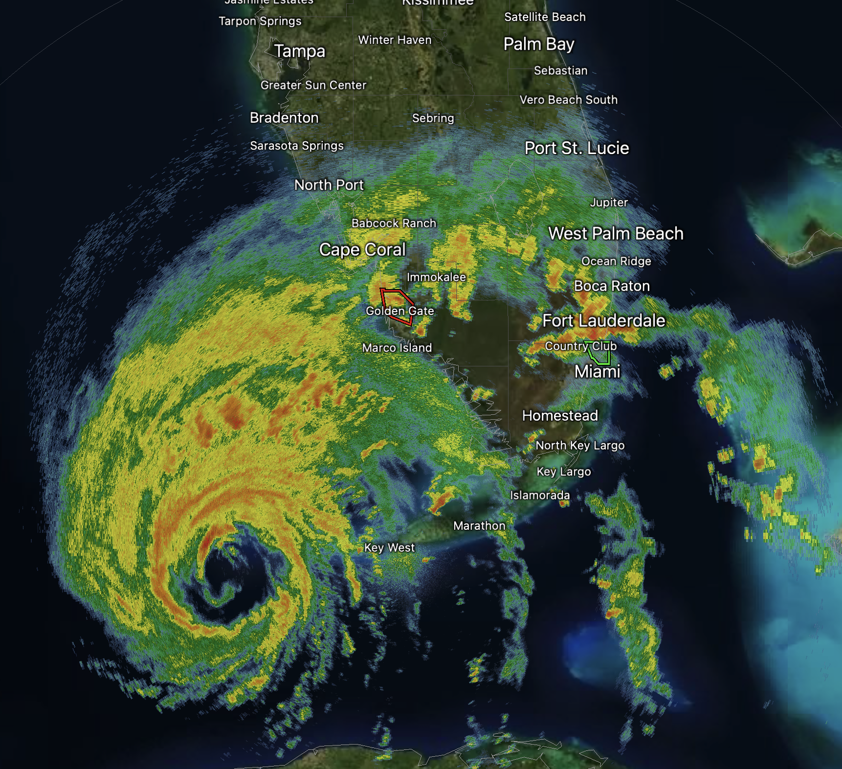
Here is the radar at 8:11pm.
Latest Forecast for Ian
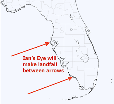
Below is my forecast of where the eye of Ian will make landfall tomorrow.

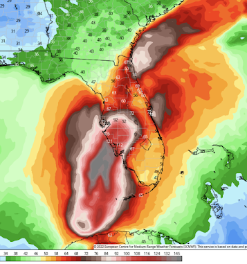
I believe the peak sustained wind speed will reach 140 mph with a chance it could be stronger. Below is a wind swath map. The actual winds could be moved 30 or so miles in any direction.
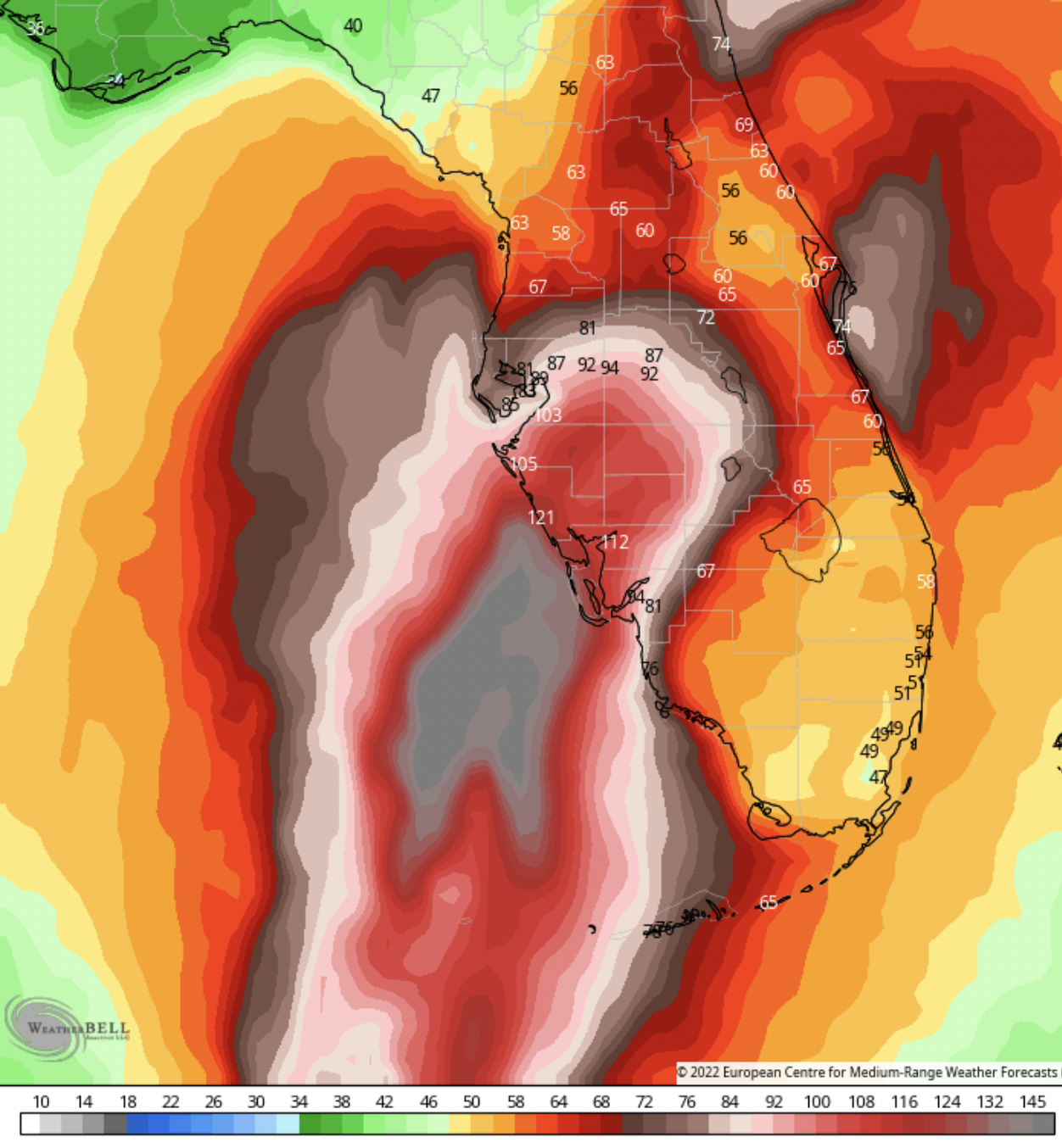
Inland: Wind gusts may reach ~90 mph in the Orlando-Disneyworld area.
Note also the winds off the Florida Atlantic Coast. More about that below.
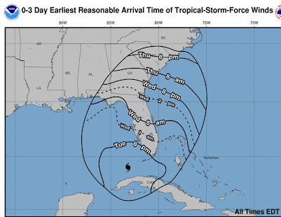
Below are the times by which your precautions should be complete.

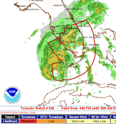
Tornadoes Have Become Active
 |
| Florida Tornado earlier today; WINK-TV News |
Multiple tornadoes touched down in south Florida this afternoon and are forecasted to continue tonight. A tornado watch (red outline below) continues in effect until 5am EDT.

Flooding rains will occur over much of the Florida Peninsula, especially in the I-4 corridor.
Outlook


Comments
Post a Comment