
Tornado Forecast Friday Afternoon to Pre-Dawn Saturday
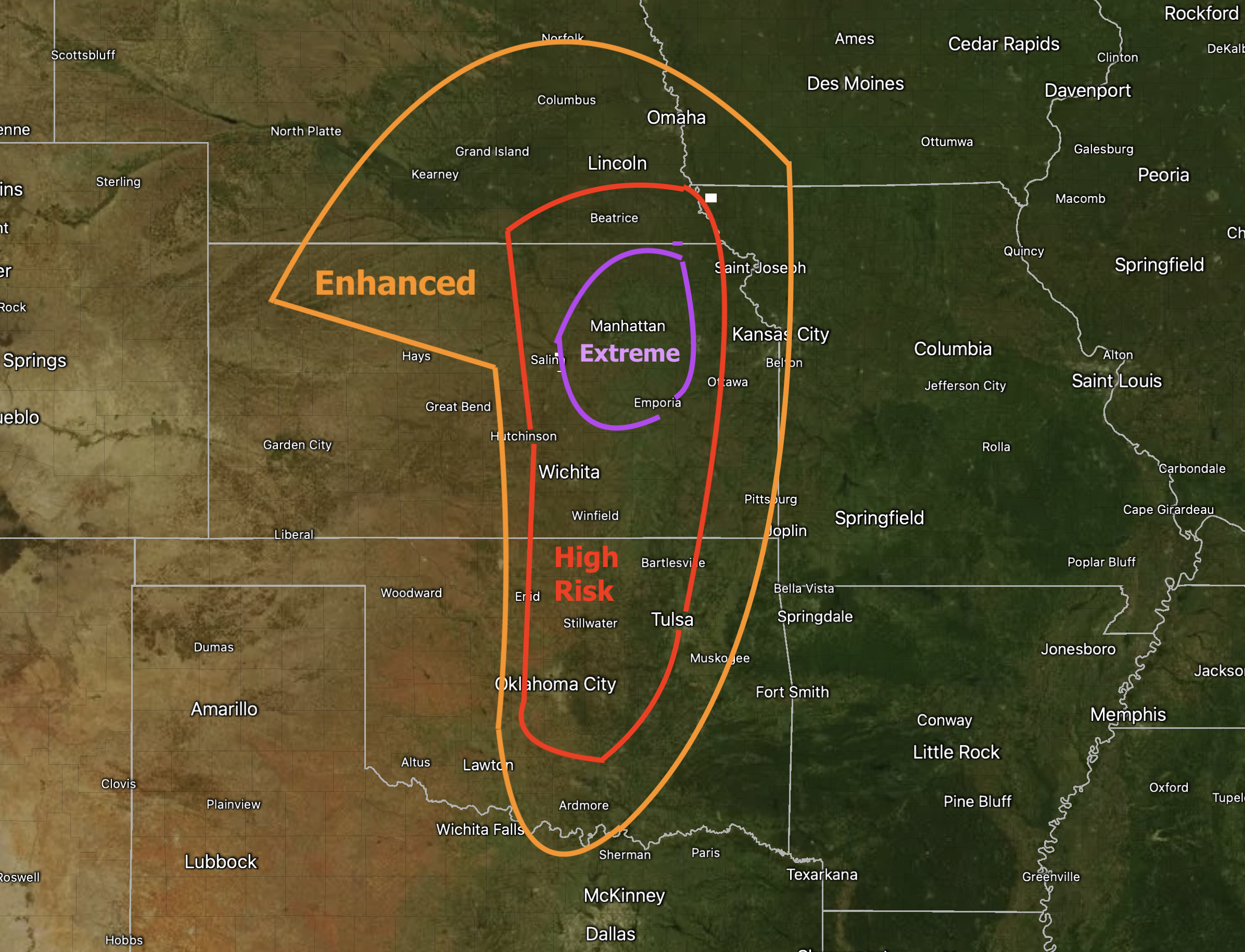
This is the first time I have used an "extreme risk" on my 4-category scale (I'm not using the lowest category of "significant" because of the nature of this event). This one of those events where, if the cap (a layer of warm air about 10,000 feet above the ground) holds, nothing will happen in the two higher categories. But, if it breaks, violent tornadoes become likely, especially in the extreme area. Let's break it down:
- Extreme Risk = Violent tornadoes possible; some occurring after dark. It is possible this area will be modified depending on where the warm front is going to end up.
- High Risk = Strong tornadoes possible; some occurring after dark.
- Enhanced Risk = A few tornadoes; north of I-70 the tornadoes will likely end before ~8pm.
Throughout the high and extreme risk areas, giant hail is likely.
If you live in these areas, please make sure your shelter is ready to go!
I'll have more tomorrow morning.


Comments
Post a Comment