Torrential Rains Accumulating From Central Kansas to Illinois
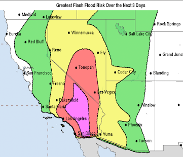
Updated Flash Flood Risk Forecast as of 8:45pm valid until 7am.
-- original post --
Since noon today, heavy rainfalls have fallen from north of Wichita to central Missouri.
Approximately nine inches have fallen in the purple area. That's a once in fifty year amount for eight hours.During the last 30 hours (since noon Thursday), extreme rains have fallen in the central Great Plains and Midwest.
Record flooding is occurring on a number of streams in Missouri. As of 9:45pm torrential rains are falling in the red areas.
More torrential rains are likely between now and noon Saturday. Please keep keep in mind that these amounts are approximate and could shift a bit.
Orange is 5" and amber (SE Kansas) is 7inches


Comments
Post a Comment