Latest Palmer Drought Index and Flood Outlook
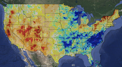
Palmer Drought Index
This data is for the week ending January 19. While some rain occurred, the drought west of the Continental Divide continues with only slight improvement. Unfortunately, below normal precipitation is expected in the West the next seven days.
Extremely wet conditions continue from Delaware to the Carolinas and then west to the Ark-La-Tex region. I'm sorry to report that forecast rainfall continues to be heavy over the next five days and likely beyond.
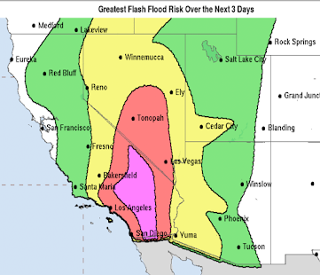
The above map is from now until 6pm CST Wednesday, March 4. Significant rainfall may occur the week after. Here is the 8 to 14 day outlook valid from March 3 to 9.Please note the above normal rainfall from the Ozarks to the Middle Atlantic region. So, if you live in a low-lying area or an area prone to flooding, now is the time to begin preparations. Here are some suggestions:- Put together a "go kit." This should include items (photo albums and other valuables) that can fit in your car.
- Keep your car in condition to leave on short notice. Make sure it has plenty of fuel.
- Don't allow prescription medicines to run out.
- Learn where to turn off water and electricity in case you should have to evacuate.
- Make sure school buses do not drive through flooded areas.
Please keep up on local weather and river forecasts. Addition: The National Weather Service in Nashville is also concerned about flooding and they have passed along a link to monitor middle Tennessee Rivers. Just click here.


Comments
Post a Comment