For Wichita
UPDATE 8:34PM RADAR: Baseball to softball-sized hail circled in gray, very high winds (gusts ≥70 mph) indicated by arrows, moving south.
UPDATE 8:33PM RADAR: The radar is measuring 70 mph gusts in the two light blue-toned areas indicated by arrows. These are moving south.
ORIGINAL POSTING:
The storms in the Newton-Halstead area will move across the entire city starting around 8:50pm in far north parts of city.
Polygons indicates areas of large hail and damaging winds. Hole southwest of downtown "Wichita" is radar location. The radar indicates gusts to 60 mph in southern Harvey Co. that may move into northern Sedgwick Co.
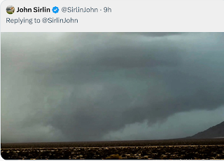
This is a view of the soon-to-be Wichita storm as is moves toward the city.
Move cars and lawn furniture indoors.


Comments
Post a Comment