Gearing Up for Tornado Season 2012, Part 6: All Tornadoes Are Not Equal
Fifty years ago, meteorologists thought that all tornadoes, more or less, were created equal. We now know that is not the case.
Without going into all of the details, we know there are at least five different ways that tornadoes can form (supercell, landspout, gustnado, squall line, and hurricane/tropical storm-related) and that we can, roughly, anticipate some limits as to tornado intensity.
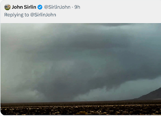
The least intense type of tornado is the gustnado (photo below).
Like the whirl that forms on the edge of a canoe paddle as it is being drawn through the water, a gustnado forms as very cold air pushes through very warm air. This type of tornado might knock over your trash can or patio umbrella but it does not pose a significant threat to life or property with untied mobile homes a possible exception. Since its duration is tens of seconds, there is a growing number of meteorologists that believes we shouldn't issue warnings on them because, in addition to the low level of the threat, the gustnado will likely be gone by the time the warning gets out.
At the other end of the spectrum is the violent (F-4 or F-5) tornado such as the storms that struck Joplin and Tuscaloosa. We are beginning to have the skill to differentiate when the atmosphere might produce this type of storm.
The supercell-created tornado can produce a tornado over tens of miles or more. Even though they are less than 2% of all tornadoes, they account for the majority of deaths.
Below is a composite image of the supercell that produced the Tuscaloosa-Birmingham tornado and others.
For example, there are now two levels of tornado watches: Regular and Particularly Dangerous Situation. If the NOAA weather radio or the radio or TV announcer uses the PDS words, there is a chance of major tornadoes.
For a regular tornado watch, I suggest you start monitoring the weather when the sky darkens or thunder is first heard. No need to alter your normal routine.
With a PDS watch, I recommend you periodically check the weather for the duration of the watch. If storms (tornadic or not) are within roughly 30 minutes, I'd suggest gathering up the kids from soccer practice, bringing in lawn furniture or anything that can be blown about, and check on elderly or infirm friends or relatives. Once everyone is accounted for, I'd make sure you are 5 minutes or less from shelter.
The PDS forecasts are not perfect. One was in effect for Tuscaloosa but Joplin was under a regular tornado watch.
This spring, keep your eye out for PDS watches. It is another step forward for the users of weather science.


"a growing number of meteorologists that believes we shouldn't issue warnings on them (gustnadoes)"
ReplyDeleteMaybe so, but how does an observer tell the difference between a gustnado, landspout, or cold-air funnel and the early stages of a "real" tornado? Is it the rotation or lack of it in the clouds above? General weather conditions that aren't right for tornadoes? Or some other factor?
Elaine
Elaine, this is a fair question. Just go with the tornado warning.
ReplyDeleteOver the holiday season we visited family members that live in Rabun County, Georgia in the far northeast part of the state near North and South Carolina. The map shows the Tuscaloosa supercell crossing Rabun County some 300 mile northeast of Tuscaloosa. At Lake Burton, over 20 mostly well built lake homes were destroyed and about 50 were heavily damaged. The Tornado struck two arms of the lake and traveled over a high mountain ridge flattening the forest.
ReplyDeleteI was amazed at the amount of damage still evident in a mountainous Appalachian environment.